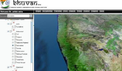
 ISRO, today launched the beta version of its web-based 3-D satellite imagery tool, Bhuvan. Bhuvan will use information captured by India's seven remote sensing satellites. Bhuvan will offer superior imagery of Indian locations.
Bhuvan Features
- Visualise 2D and 3D image data along with rich thematic information on Soil, wasteland, water resources etc.
- Fly to locations ( Flies from the current location directly to the selected location)
- Heads-Up Display ( HUD) naviation controls ( Tilt slider, north indicator, opacity, compass ring, zoom slider)
- Navigation using the 3D view Pop-up menu (Fly-in, Fly out, jump in, jump around, view point)
- 3D Fly through (3D view to fly to locations, objects in the terrain, and navigate freely using the mouse or keyboard)
- Drawing 2D objects (Text labels, polylines, polygons, rectangles, 2D arrows, circles, ellipse)
- Drawing 3D Objects (placing of expressive 3D models, 3D polygons, boxes)
- Snapshot creation (copies the 3D view to a floating window and allows to save to a external file)
- Measurement tools (Horizontal distance, aerial distance, vertical distance, measure area)
- Shadow Analysis (it sets the sun position based on the given time creating shadows and effects the lighting on the terrain)
Bhuvan’s edge over Google Earth
Google Earth’s Zoom levels up to 200 mt – ISRO’s Bhuvan Zoom levels up to 10 mt
Google Earth: Single layer information – ISRO’s Bhuvan: Multi-layer information
Google Earth: Images upgraded every 4 years - ISRO’s Bhuvan: Images upgraded every year
Google Earth: No alternate viewing options – ISRO’s Bhuvan: Options of viewing on different dates
Google Earth: Uses international satellites – ISRO’s Bhuvan: Uses Indian satellites
How to Download & Install Bhuvan?
Register here. Download the Bhuvan plugin from here (its actually Skyline’s terraexplorer plugin) and Microsoft’s DirectX.
In order to install the plugin, you need to have the administrator privilege in your machine. The product works only in IE and is quite buggy to start with.

No comments:
Post a Comment